
Mapping Norfolk Island's convict past
The British settlement of Norfolk Island in 1788 brought with it all the hallmarks of that Empire’s particular brand of colonisation: bureaucracy and cartography. Though hampered by the near-destitution of the settlement during the early years, the island’s administrators still managed to convey reports, accounts and surveys back to New South Wales. These show a establishment of convicts, military, free settlers and ex-convicts clawing a living from the island, reliant upon irregular supply ships from New South Wales. The island’s population peaked at near 1,200, concentrated in the main southern settlement of Sydney (later Kingston), but also spread across the series of grants which subdivided the island. Wheat, maize and subsistence crops were attempted, with extensive harvesting of timber and flax also taking place.
As with our other mapping projects (Port Arthur, Van Diemen’s Land and convict Australia) we recognised that the availability of administrative and spatial records provided us with an opportunity to better understand the topography of British settlement. Using contemporary maps, grant boundaries were traced across. This illustrated how the settler’s claims upon the island were very much concentrated in the island’s southern and eastern halves, with a small number situated near the northern centres of Phillipsburg later Cascades). The area around Mount Pitt and the north west of the island remained largely unsettled.
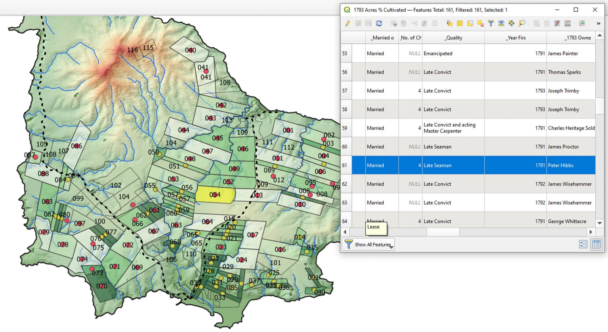
With the extent of grants and settlement mapped, we were then able to begin the process of data linkage. Each of the grants had been occupied by a free settler or emancipist and their families. Returns of the settlement, including particularly detailed returns from the post-1810 period of evacuation, showed who had occupied the grants, as well as their material holdings. With this we could then build up a time-series map of the island, illustrating not only the distribution of grants and people over the island, but also how this composition changed between 1788-1814.
You can use the map below to explore the grants of Norfolk Island between 1788-1814. If you wish to view the map in another window, click the link.